62 Unfortunate encounters with short cuts
In my 9th grade geometry class, we were taught that the shortest distance between two points is a straight line. Later I learned that Euclid was misguided.
62.1 Half Dome
In autumn 1963, Con Van Arsdall and I left Deep Springs for a backpacking trip in the Sierras. We got a ride to Tuolumne Meadows in Yosemite National Park and then started hiking to Yosemite Valley.
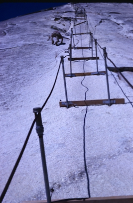
We hiked past Cathedral Peak (Note: John Muir made the first ascent in 1869) and camped near the pass on the east side of Half Dome. The next day, we climbed Half Dome, largely friction climbing and not hanging on to the cables (on the way up!). This was my 3rd ascent of Half Dome, and I’d seen only two other people on the dome on those trips. Currently, the cable route is a conga line.
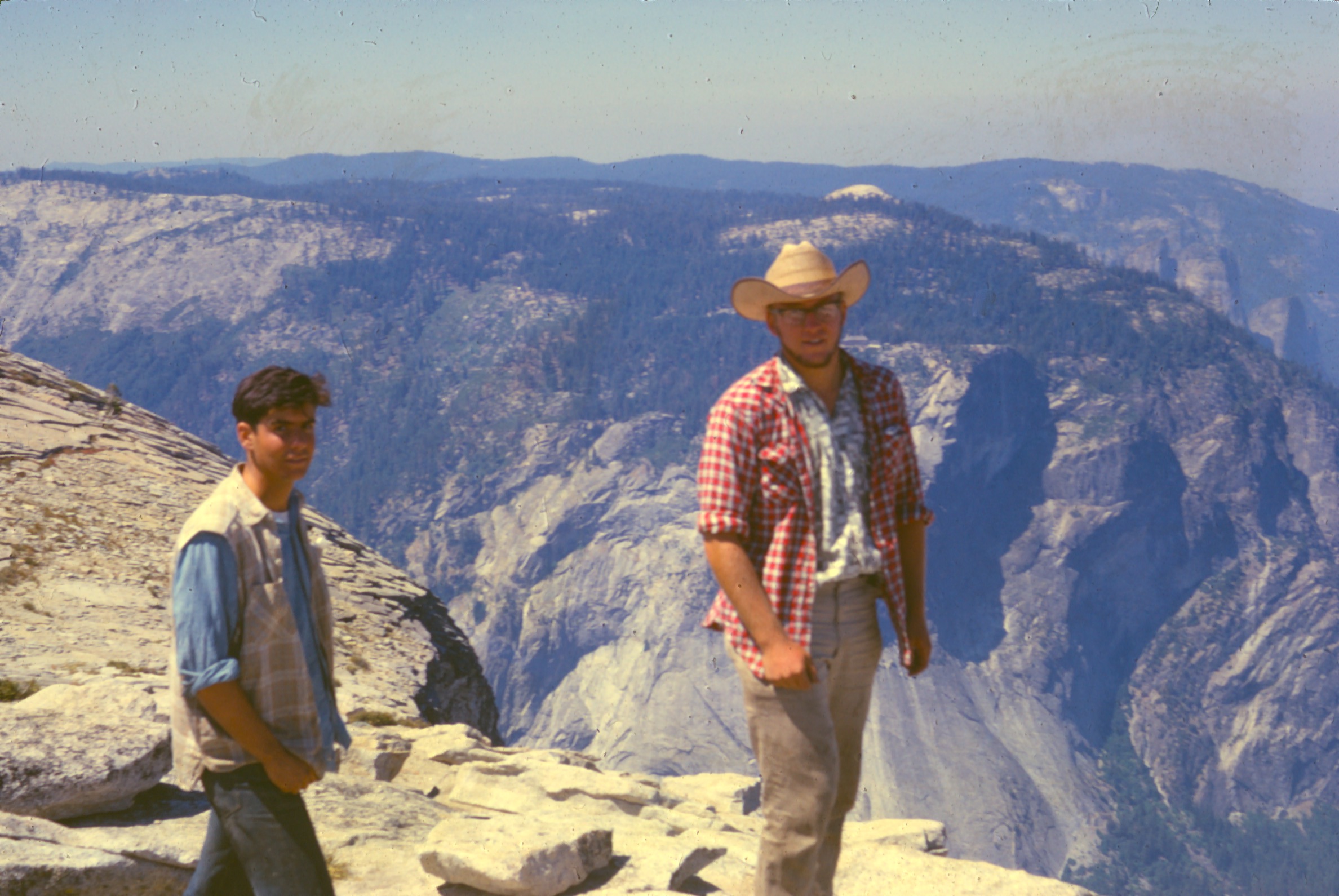
From the top, we looked down the 1500-foot vertical face and saw that at the face’s bottom (1500 feet below us), the terrain slopped down to the valley floor. We thought, hey, why take the trail to the valley? I’d done that twice and knew it would be boring. Instead, let’s take a shortcut.
Looking down, we saw lots of green (grass?) below the north face. We thought it looked like a steep but easy shortcut to the Valley below. So, after descending the cables on the dome itself, we traversed below the face (N side), and then headed down slope towards the Valley.
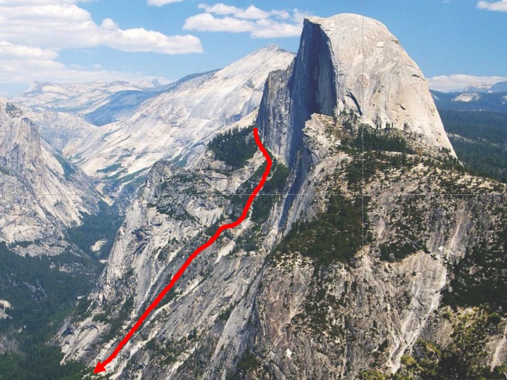
The going was easy at first. But then we discovered that the green we’d seen from above was manzanita thickets, not grass. At times, we’d have to claw our way over or through manzanita, which was tiring and dusty. Moreover, the day seemed hot for autumn, and soon ran out of water.
By late afternoon, we were within 100 vertical yards from the Valley floor but were abruptly stopped by an unwanted cliff. We paced back and forth, looking for a way down. Finally, we saw that if we slide down a 45° chute (perhaps 25 yards long, but angling to our right) and that if we could catch a small tree at the base, then we’d then be able to follow a narrow ledge down to the Valley floor. But it we couldn’t catch that tree, we’d catapult over the cliff and…
We were exhausted but came to our senses and searched for another way down. We spotted and started crossing a narrow ledge to a safe way down. I slipped on some moss and slid about five feet to another ledge below. I looked up and saw ten “claw” marks running down the mossy rock, as I’d tried to scratch-arrest my fall. No damage (other than scraped fingers and an exteme adrenaline rush), and we were soon at the valley floor.
We walked over to Camp Curry, rented a tent for the night, ate a huge meal, and crashed. That experience should have taught me not to take shortcuts.
62.2 Cross-country in Botswana
The notes below describe a misadventure in March 1976. Eric Pianka and I’d studied ecological interactions between two species of Mabuya (striata, spilogaster), which had partially overlapping ranges. By plotting known localities on a map, I guessed that the zone of sympatry must end a few km into Botswana – thereafter, only spilogaster would be present further east. So I wanted to pinpoint the edge of striata’s range.
So I organized a day-trip, heading cross-country and east into Botswana. I was accompanied by Ward Russell (in his late 60s and a friend of ours from the Museum of Vertebrate Zoology) and Titus, a young (~ 13) African boy. Warden LeRiche had insisted that we take Titus, who was to make sure that didn’t get into trouble.
The plan was to drive for a few km, look for a grove of Acacia trees, and determine whether striata was still present. If so, then we would drive a few more km, etc. I soon realized that the edge of a species range isn’t abrupt. We would stop at a grove of trees and not find striata. Great, until I drove a few Km further but then found striata again. Either I was cutting across the range boundary at a very slight angle, or the probability of finding striata in any given grove of Acacia was dropping slowly with distance. At some point I realized the whole idea was a bust. Moreover, we were having problems with the Land Rover overheating, as the radiator packing with grass seeds.
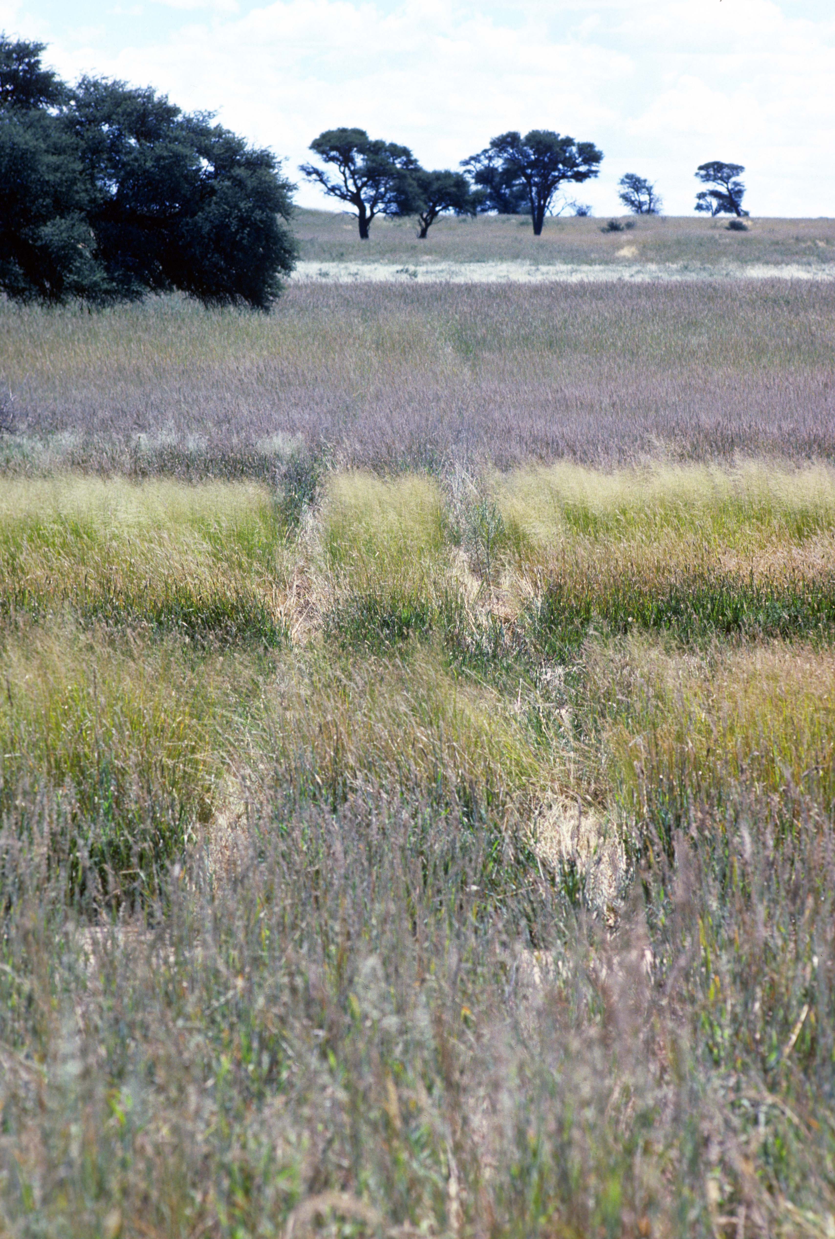
The Kalahari was seriously wet that year. The grass was thick and high, and grass seeds clogged our radiator. Moreover, the sky was dark and cloudy, and so sun and shadows were barely visible at midday.
I realized that we were in trouble. We were running low on petrol. We had limited food, limited water, and no sleeping bags or tent. I decided to stop driving, thus preserving some petrol, and wait to be rescued.
While waiting, I wrote extensive notes. If we weren’t rescued, my notes would record what happened. Also, writing was a needed distraction for me! My notes (extensive and unedited) are in a ‘callout-note.’ You can expand the text if interested.
“These notes are written beginning 1320 on 9 March [1976]. Ward Russell, Titus, and I left Nossob Camp yesterday morning about 8+ am. Our intent was to drive to Kameel Sleep & then head east for 35 – 50 km. We wanted to locate the eastern limit of the range of Mabuya striata sparsa.
The initial mistakes were made before leaving. First, the Land Rover’s radiator was not covered with a grass screen. Second, to cut down on weight, I left one jerry can of petrol & one large water container. Thus we were carrying [only] about 10 gal of petrol in addition to the L.R. tank which was ~ ¾ full, one large water container, & 3 canteens [water].
We drove to Kameel Sleep. Here the river makes a big bend to the east. It seemed somehow not like a good place to start out on a trip going east. So I doubled back 10 km or so to where the dune road joins the Nossob. This is what we used to call Kameel Sleep on our last trip. So I assumed that our departure point would be spotted [in the event of a rescue] To this end I drove back and forth crossways across the road and made an (arrow figure) in the sand.
Then we headed east – or what I assumed was east – driving into the shadows cast by the grasses. We made very few stops until we reached km 36.2. By this point we had already begun to have trouble with the Land Rover’s overheating. Initially, I assumed I was driving in the wrong gear, so I changed. This had little effect.
Finally around 1 pm I decided we should head back. The clouds were coming in very rapidly & a wind was blowing strongly. I tried to follow the entry tracks of the Land Rover but the wind & the high angle of the sun made this difficult. So I started driving a course which I thought was lightly south of the one we had entered on, hoping to hit the bend of the Nossob near Kameel Sleep. It was my impatience at trying to follow the tracks that led to this decision.
To check directions, I periodically referred to the compass, setting a west course. Subsequently we learned that the compass is screwed up. If one is very close to the Land Rover, it seems to go haywire. Even at a few yards, it is unpredictable.
Because of the ensuing storms & confusion with the compass, I am uncertain as to our eventual route. Around 4, I think, we final saw the sun periodically break through the clouds. At this point we must have been traveling more or less north northwest. So we changed bearing and headed into the sun, our slightly to the south of it.
By this time we were having lots of trouble with the radiator – it was packed with grass. We could only drive a few Km before it would boil. This of course made heavy use of our water supply. We didn’t mind initially, since we were certain the river was close. However, when the water can got to be ~ 1/3 full, we decided it was best to stop & wait, hopefully, to be rescued.
It was growing dark by this time. We started to build a fire, but couldn’t get it going – the wood was wet. So we had a little to eat & went to sleep in the Land Rover. Ward slept in the front & Titus & I in the back. We used the one folding cushion and the car seats for insulation, but didn’t have any blankets.
It was cold during the night, & it rained, though not heavily here. I hoped that it didn’t rain heavily were we turned off from the Nossob [see below].
It was we think a sleepless night, or essentially a sleepless one. The rain had stopped by sunrise, and we arose early. It was cloudy, but, just in case of an air search, we wanted to increase our chances of being seen. We spelled out radiator in the sand with branches. Then we took the two 2x3’s from inside the truck, lashed them together, tied a curtain to it as a beacon, & attached it to the top of the Land Rover.
Next I decided to attempt to clean the radiator. Initially I tried using the whisk broom – this was slightly effective. Then I took bailing wire & probed between the crevices trying to force the grass seeds through. This was very frustrating & time consuming,& not clearly the ideal approach. The air pump for the tires was tried with no success. Then I remember that Carolyn might have left a can of dust off [with] her camera in the green bag. She had & I used it with success until it ran out of air – which it did very quickly, since it was a small can. Then back to using bailing wire. Ward helped at first, but had little patience. Eventually I gave up too.
[NOTE: our camp was 77.7 km from out from our turn around point. Thus we traveled 103.9 Km after leaving the Nossob. Our gas tank was now only ¼ full, but we didn’t want to run out. And we didn’t dare use the remaining water to to fill the overheating radiator. Stopping was a good idea.]
Periodically during the day Ward or I would get an idea. Ward suggested finding a sociable weavers nest for fire building material – the inside might be dry. However, the only one in the vicinity was very awkward to get at, so we gave up on this.
I found a log which seemed dry & got some kindling in case we decided to build a signal fire. We had 2 cans of oil & lots of rubber to burn for smoke – if we can get it working.
It is virtually impossible to communicate w/ Titus, as he understands & speaks essentially no English. Ward is tired & depressed & doesn’t respond to my attempts at humor – e.g., asking if LeRiche will salute our banner when he arrives.
I personally feel reasonably safe. My only worry is that they won’t find our entry point – a herd of gemsbok or a heavy rain might wipe that our tracks. Then if the clouds hold & the airplane stays grounded, we could be in trouble.
A quick glance around didn’t reveal any Tsama melons or cucumbers for emergencies – perhaps they are absent because of the fire last year. There are lizards –Agama, Mabuya striata, M. spilogaster, M. occidentalis, & possibly E. lugubris. [potential food]
Titus & I cut some grass which we will use tonight for insulation – the pads we will use instead for blankets: Ward & I cut some other grass to make him some pillow out of the lunch sack and Carolyn’s green bag.
4 pm. It is clouding over – some rain on the horizon. Botswana looks bigger & bigger.*
~5 pm the rain started – we started to move in the cut grass which had been drying on the dune. Our little adventure for the day was the horned adder under our grass pile! I killed & buried him – later I regretted not preserving him, but, anyway, our locality data is inexact.*
The rain was good for an hour & we filled most of our small water jugs. We had set out the blue plastic tray & cut the side off one of the empty big water jugs. I took a green plastic sun visor, which Raymond Kidson [a friend from Upington] had given us, attached it to the windshield, & let it serve as an additional catchment for water.
Titus & I collected water from leaks inside the Land Rover. I used to swear at them, but the water tasted good. I think we gained water on the day.
Ward & I have been discussing how to fill the radiator. I volunteered the formalin from the specimens and some alcohol. Ward suggested we collect urine as well. A good idea – it was interesting trying to explain to Titus what we wanted.”
Addendum (25 April 2022) from memory.
I wrote no more notes during that misadventure. Despite all the uncertainty of those two days, I loved the vista east into Botswana. I’d parked on top of a dune (so we’d be conspicuous to any rescuers). When the sun came out, I looked to the east and saw a herd of eland moving majestically through the veld. They didn’t see us. I felt like I was in primordial Africa – it was a pristine and beautiful, with nothing human as far as I could see. I was happy.
We went to sleep at dusk. We were cold, despite the grass insulation beneath us. Titus and I slept with our backs fused together. Social distancing was not an issue despite our cultural differences.
It was almost dark when we heard a rifle shot to the east. I jumped up immediately, turned on the Land Rover’s lights, and probably honked. When we heard a second rifle shot, we started the Land Rover started driving to the east, where we could see the lights of a vehicle. Warden Le Riche, an assistant, and several African staff had come for our rescue.
Ironicallhy, their Land Rover had broken down just a ¼ mile from us! Now we had to rescue them. I’ve often wondered what would have happened if they had broken down 20 km from us. Would they have tried to follow our tracks by foot? What then?
Fortunately, they did break down near us. They had extra petrol, and we filled our tank. Everyone packed into our Land Rover and headed west towards the Nossob. Le Riche drove slowly and carefully steered a heavily laden Land Rover (seven adults inside) up and over the dunes. He knew how drive on sand, and we never got stuck. I was impressed.
It was raining heavily, and we could barely see. LeRiche would periodically ask one of his scouts whether we were still heading west. The scout would wipe off the condensation clogging side window, look outside, and say, “Yaaoouu, Boss!” Decades later, I can still hear his melodic voice.
LeRiche eventually decided that his scout couldn’t tell direction, so he decided to stop for the night. Fortunately, the rain had stopped for a while. LeRiche told his scouts to collect fire wood and build a fire. I pointed out that the wood was soaking wet. LeRiche just looked at me and said nothing. Then he took a jerry can of petrol, poured some on the wet wood, and lit a match. It was a miracle – wet wood burns! We all slept huddled around that warming fire.
Skies were clear the following morning, and even I knew which was west. We drove to the Nossob and up it to Mata Mata. I assume that LeRiche sent a team back to rescue their abandoned Land Rover.
Overheating was not an issue on the return drive, despite our load. Perhaps the radiator cleaning I’d done the day before solved the problem.
LeRiche never criticized me for this misadventure – I suppose he had seen dumber episodes during his long tenure as Warden. He let me know that I’d made the classic blunder when lost – that is, drive in a big circle rather than in a straight line. The extra distance I’d driven helped explain why we were surprisingly low on petrol. In any case, I should have noticed when I had crossed our own tracks, but I didn’t. No doubt LeRiche’s trackers got a good laugh over our incompetence.
Lessons from this misadventure are many. Take extra petrol, water, food, and sleeping gear, especially when heading cross country. Cover the radiator with a screen if driving through tall grass. Take a compass but take readings away from the vehicle. Don’t take shortcuts.
Currently, of course, one can use GPS and satellite systems to navigate and communicate. I never go hiking or driving without these aids.
62.3 Telescope Peak, California
One Christmas vacation (~1977), Ross Kiester and I decided to climb Telescope Peak (11,049 ft), in the Panamint Mountains bordering the west side of Death Valley, California. We’d been visiting our families in Southern California. Ross borrowed a car, picked me up, and we drove to the trailhead, which was about 16 miles north of Telescope Peak. We camped part way up the trail. The sky the following morning was remarkably clear – no clouds, no haze, nothing. Only the curvature of the earth seemed to limit our views. I was convinced that I could even see White Mountain, 120 miles to the northwest. I wish I’d had a map and compass.
To our east was Death Valley, two vertical miles below us. We watched a raven soar quickly from near the valley floor up and over us – never flapping. To our west was Panamint Valley and the road we’d taken to the trailhead the previous afternoon.
Then we had a ‘brilliant’ idea. Why take the trail back to our car? That would be boring. Let’s head down a major canyon down the west slope of Telescope Peak, hike to the Valley floor, hike out to the highway, and hitchhike back to the trailhead. Our route was obviously farther than the trail, so it didn’t technically qualify as a ‘shortcut,’ but it appealed to us at the time.
Down we went. Unfortunately, what looked easy from above quickly became increasingly less so. The canyon was wide near the top but gradually narrowed into a steep-sided and rocky ravine. The bottom was choked with vegetation, and we often had to bushwhack our way through. Dry cattails clogged one section. Without a machete, we had to fall forward and body-smash the cattails. Stand up and repeat. It was late December, but the canyon was surprisingly warm and dry – and dusty.
You are correct in suspecting that we were running short of water: that canyon was bone dry. We reached the valley floor in the late afternoon – thirsty, hungry, and tired. We found some water and started walking west to the highway, but stopped to sleep in the desert. We resumed hiking early the following morning. The road was only 5+ miles from the mouth of the canyon, but that was farther than we’d guessed (distances are deceptive from the top of peaks) and felt much farther as well. We were beat.
We reached the highway and expected to get a ride. But this was a Sunday morning, and cars were very few and very far between in Panamint Valley. Eventually, one car stopped and generously drove us to the trailhead. Then we dashed to Long Beach, where I caught a plane back to Oakland. I boarded my flight with moments to spare.
That trip was far more exciting and memorable than it should have been. Given my experiences below Half Dome and in Botswana, I should have known to ignore the appeal of shortcuts. Alas, some of us must be slow learners.
I hope that I have relegated shortcuts to my past. Trails may not be the shortest or most interesting routes, but ignoring trails may lead to trials.