16 Encountering a fork in the road
Larry and I arrived in frontier town of Upington on 23 November 1969. After shopping for supplies, we headed out into the desert. Our immediate goal was to find and establish 8 to 10 study areas – characterizing different habitat types – scattered about the Kalahari. We’d need to visit each site every month for the next 10 months or so and hopefully catch a lot of lizards during that time.
Eric’s project was designed to determine whether the number of lizard species on a site correlated with the local vegetation diversity. The underlying concept was simple: if a site had only small shrubs, it should support only ground and shrub-loving lizards. But if a site also had some big shrubs and trees, it could support additional kinds of lizards, including strictly arboreal ones. In other words, the diversity of lizard species should parallel the diversity of vegetation structure. Robert MacArthur found this pattern with birds in Eastern North America, and Eric Pianka found a similar pattern in his studies in the deserts of North America and Australia.
Larry’s and my first goal was to select sites that had different vegetation types (grasslands to forested) or physical structure (dunes, no dunes): once we found all the lizards that occurred on each site, we could determine whether the number of different lizard species on a site increased with the diversity of the vegetation and of its physical structure.
But how does one know where to find diverse sites without good floristic maps or Google Earth, or how to get back to them without GPS? Before we got to the Kalahari, we hoped to set up one or two sites in the Kalahari Gemsbok Park, an unfenced and sheep-less area jointly operated by South Africa and Botswana. These would be pristine Kalahari habitats. But we would still need to find 7 or 8 other sites scattered about the Northern Cape, southern Botswana, and South West Africa. Most of these areas sustained sheep farms.
In the absence of maps, we did the obvious – drive around haphazardly, exploring different regions, hoping to stumble across suitably diverse sites that also had lots of lizards. This plan was far from ideal, but we had no other choice.
We had SA Automobile Association road maps showing the main tracks (no track was paved) in the Northern Cape and in South West Africa. Unfortunately, these maps were crude, inaccurate, and provided no hints about vegetation or topography. We had to guess which tracks to search. Many road forks were not sign posted (the locals, of course, knew where they were and didn’t need signs). GPS was decades away.
Navigation became a concern in a region crisscrossed with unmarked tracks. If a given track proved uninteresting, could we retrace our steps? Feeling lost is awful, and Larry and I had absolutely no interest in getting lost in the Kalahari.
So what should two young biologists do when they come to an inevitable and un-posted fork in the road? This was one of the first questions we asked ourselves as we left the security of Upington on Day One in the Kalahari. I don’t recall which of us came up with the answer – I suspect we both thought of it as soon as we discussed the issue. The answer was obvious: At any fork in the road, turn left.
Why obvious? The underlying logic was appealing: if we got lost or if the area was uninteresting, and we needed to backtrack, we would always know which way to turn when retracing our route. For example, if we had turned left at each of two successive forks, then all we had to do to get back to where we started was to turn around and make right turns at the next two forks. We’d have wasted time and petrol, but no harm, no foul. And no route memorization was required.
Honestly, any concerns we had about getting lost in the southern Kalahari soon evaporated. We quickly discovered that the entire Northern Cape Provence was covered with karakol (sheep) farms, and so one could not be lost for long. Find the nearest farmhouse (not always easy) and ask directions (not always easy either, as most of the farmers were Afrikaaners and many didn’t speak – or wouldn’t speak – English). But our ‘always-turn-left solution’ would prove useful months later when we were driving on unmarked and confusingly intersecting tracks in far northern Botswana. I’ll turn to that experience later.
We immediately liked our solution, but I think we overlooked one problem, namely, that if one continued forward but always turned left, that we would often end up going in circles. So, to get to the eastern Kalahari, we had to break our rule and reluctantly turn right.
In any case, why did we choose to turn left? Why not turn right?
Simple answer. This was the late ’60s, which was a liberal era for college-age youths, especially those who had been students in Berkeley, Austin, or both. This was an era of sex, drugs, and rock and roll – though not necessarily in that order – and very liberal politics. Neither of us wanted to be associated with turning right!
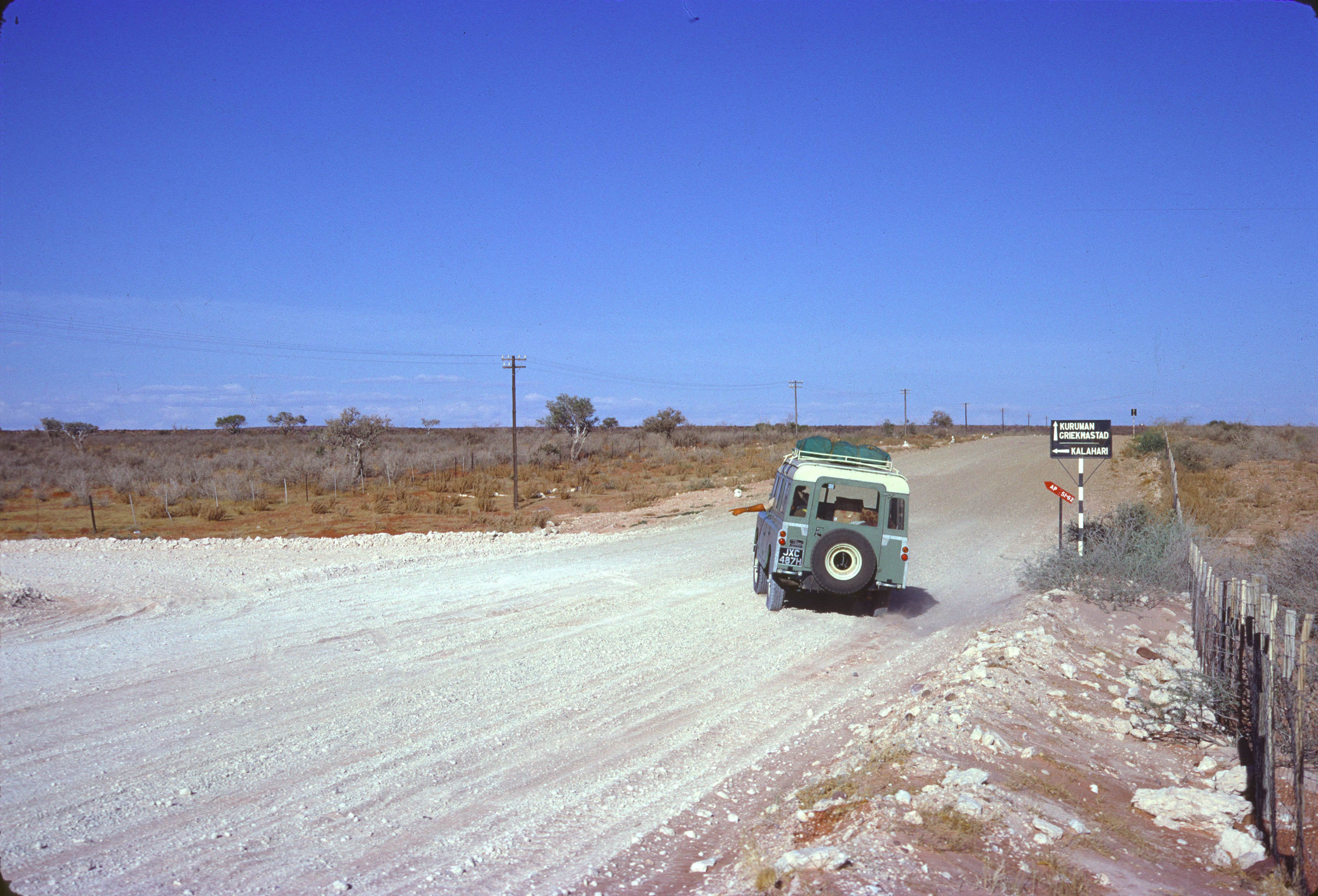
Driving east from Upington on an unpaved road on Day One (1969-11-23), we decided that our official trip tagline should be “Turn left at the Kalahari!” Remarkably, we spotted a dirt track heading north from the main road just a few miles out of Upington. There was a conspicuous sign pointing to the left and one word emblazoned that sign, “Kalahari.” We were finally at the Kalahari. We stopped to immortalize the moment in a staged photo with Larry turning left (but skidding slightly, as I recall) with the Kalahari sign in the background. We were clean, still clean-shaven, and admittedly anxious but excited. We turned left and headed north for an adventure in the desert.